Carlsbad Caverns National Park
I am so sorry for the delay in posting this article today. Aside from having an extremely hectic schedule today and being behind the gun a bit. I wanted to give this article the justice it deserved because I found this particular place so intriguing when I first discovered it. One of the advantages of doing this blog is I get to experience all these places virtually before I share them with you, and I enjoy looking up the folk lore of certain places.
One of the things I was privileged to do at a young age was to travel outside of the country with my family. Going to Canada was nothing new, we had done that a few times since I was a child. However, going to Acapulco Mexico was more than just a vacation, it was an adventure ahead of time learning about the culture, their trading practices, the legends or folk lore of the city, and the places that were around it. I enjoyed learning about their culture and history, but most of all I enjoyed discovering cool places to go see. Every time we traveled out of the country I was encouraged to take time ahead to learn about it, so that it was more than just a vacation, it was an opportunity to learn.

Carlsbad New Mexico has an interesting folk lore, and among it's interesting places to visit, the Caverns are on the top of the list
. Between the
indigenous bats and the unearthly rock formations, these caverns offer another opportunity to see one of the earths natural wonders.
The
largest cave chamber, the Big Room, is a natural limestone chamber which is almost 4,000 feet long, 625 feet wide, and 350 feet high at the highest point. It is the third largest chamber in North America and the seventh largest in the world. The park contains 116 caves.
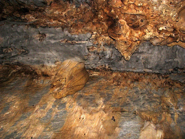
This is the The Chandelier Ballroom in Lechuguilla Cave. Lechuguilla Cave is the 6th longest cave in the world (4th longest in the United States) and the deepest limestone cave in the country. The historic cave contained a 90-foot (27 m) entrance pit known as Misery Hole, which led to 400 feet (122 m) of dry dead-end passages.
Until recently, the National park was closed due to a fire that stretched across 30,438 acres along Highway 62/180 from Rattle Snake Canyon to Dark Canyon Road, leaving charred remains of desert plants in its path.
Balloon Ballroom
- Located in the ceiling above the main entrance hall, this small room was first accessed by tying a rope to a whole bunch of balloons and floating them up into the passage.
- Bat Cave
- A large, unadorned rocky passage connected to the main entrance corridor. The majority of the cave's bat population lives in this portion of the cave, which was mined for bat guano in the early 20th century.
- Bell Cord Room
- Named for a long, narrow stalactite coming through a hole in the ceiling, resembling the rope coming through a church steeple to ring the bell. This room is located at the end of the Left Hand Tunnel.
Bifrost Room
- Discovered in 1982, it is located in the ceiling above Lake of the Clouds. Its name refers to a Norse myth about a world in the sky that was accessed from Earth by a rainbow. The room was given this name because of its location above the Lake of the Clouds and its colorful oxide-stained formations.
- Big Room or The Hall of the Giants
- The largest chamber in Carlsbad Caverns, with a floor space of 357,469 square feet.
Chocolate High
- A maze of small passages totalling nearly a mile in combined length, discovered in 1993 above a mud-filled pit in the New Mexico Room known as Chocolate Drop.
- Green Lake Room
- The uppermost of the "Scenic Rooms", it is named for a deep, malachite-colored pool in the corner of the room. In the 1940s, when the military was testing the feasibility of Carlsbad Cavern as an emergency fallout shelter, the Green Lake was used to look for ripples caused by a nuclear bomb test many miles away. None appeared.
- Guadalupe Room
- Discovered by a park ranger in 1966, this is the second largest room in Carlsbad Caverns. It is known for its dense collection of "soda straw" stalactites.
- Hall of the White Giant
- A large chamber containing a large, white stalagmite. Rangers regularly lead special wild-cave tours to this room.
- King's Palace
- The first of four chambers in a wing known as the "scenic rooms", it is named for a large castle-like formation in the center of the room.
- Lake of the Clouds
- The lowest known point in the cave. It is located in a side passage off the Left Hand Tunnel. It is named for its large lake containing globular, cloud-like rock formations that formed under water when the lake level was much higher.
- Left Hand Tunnel
- A long, straight passage marked by deep fissures in the floor. These fissures are not known to lead anywhere. The Left Hand Tunnel leads to the Lake of the Clouds and the Bell Cord Room.
- Mabel's Room
- A moderate-sized room located past the Talcum Passage in Lower Cave.
- Mystery Room
- A large, sloping room located off the Queen's Chamber, named for an unexplained noise heard only here.
- New Mexico Room
- Located adjacent to the Green Lake Room and accessed by means of a somewhat narrow corridor.
- New Section
- A section of fissures east of the White Giant formation and paralleling the Bat Cave. New discoveries are still being made in this section.
- Papoose Room
- Located between the King's Palace and Queen's Chamber.
- Queen's Chamber
- Widely regarded as the most beautiful and scenic area of the cave. Jim White's lantern went out in this chamber while he was exploring, and he was in the dark for over half an hour.
- Spirit World
- Located in the ceiling of the Big Room at its highest point (an area known as the Top of the Cross), this area is filled with white stalagmites that resembled angels to the room's discoverers.
- Talcum Passage
- A room located in Lower Cave where the floor is coated with gypsum dust.
The Rookery
- One of the larger rooms in Lower Cave. A large number of cave pearls are found in this area.
- Underground Lunchroom
- Located in the Big Room at the head of the Left Hand Tunnel. It contains a cafeteria that was built in the 1950s, and is where the elevators from the visitor center exit into the cave.
More information about Carlsbad Caverns at
Wayfaring.com
TRAVEL LINKS:
Fly Cheap! Airfare Secrets Revealed!
Adventures into the Unknown
The Travel Secrets Guide
Fly Cheap! Airfare Secrets Revealed!
Insider Cruise Tips!
WILDLIFE DISCUSSION FORUMS:
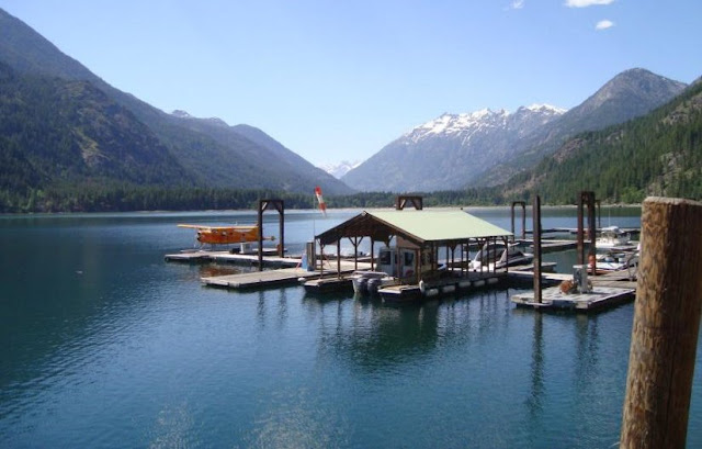
 Have you ever just wanted to get away from the rat race so bad that you wanted to go somewhere you couldn't be easily found, just to have a few moments of peace? If so, I have the place for you! In fact, they didn't even have standard telephone service in this place until 2007, that's how remote this place is. And it can be found in central Washington state. The only hitch is that you can't get there by car lol.
 , with it's modest population of 75 and an old fashioned style school house providing a single classroom, is nestled in the southern region of the North Cascade National Park and at the northwest
  end of Lake Chelan. It is the ultimate get-a-way destination, especially if you are someone who enjoys remote locations to relax and enjoy the beautiful scenery of nature. There are old style rustic lodges, horseback riding, biking and hiking trails, and many more activities to participate in if you want to venture out. Although there are not any roads which you can drive to get you there, you can take advantage of the ever famous "Lady of the Lake
 " ferry or take a dinner cruise on the "Innamorata" (once owned by the late Dean Martin) and start your vacation off with a collection of breath taking views
 along the way.
 is fed by glacier melting which comes down the Stehekin river and flows into the 55 mile long lake. The valley of Stehekin was carved by ice age glaciers and now provides a fantastic challenge for white water rafters who are interested in taking on the remote Stehekin River. Be ready for a challenging experience with this one, I hear the higher up the river you put in, the more excitement you will experience.


